


Microsoft has been enhancing its Bing Maps offering with new “Top of the World and High Resolution Satellite Imagery” which includes bathymetric shading showing the topography of the ocean floor. In addition, areas of maps with cloud coverage have been analysed and views provided with reduced cloud according to the Bing Maps Blog. This is a big update to Microsoft’s Bing Maps (and also Microsoft’s Windows 8 maps app) with over 13 million sq km of updated satellite imagery.

Bing Maps’ seamless base satellite imagery of the entire globe is provided by TerraColor at a resolution of 14 metres per pixel. Top of the world imagery is viewed by users at zoom levels 1 through 13. At closer levels users see high-resolution satellite images which have also been updated as mentioned above.
Zoom in closer still and Bing Maps presents you with high resolution orthophotos taken from aircraft. It is these photos which you zoom into to see your own house or neighbourhood. When I was looking to move house I often looked at both Google Maps and Bing Maps images of the house and area in which I was considering. I’m happy to see that Bing still has the “Bird’s Eye View” available so you can get a perspective angled view of areas to complement the top down ortho views. I find the angled Bird’s Eye View gives a better feeling of the area on the ground.
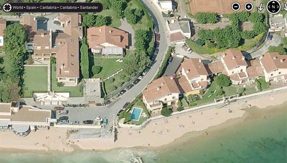
Bird's Eye View of a portion of the Spanish coastline
The Bing Maps Blog informs us that “Our latest release of Global Ortho imagery includes 203,271 sq km of new data! In total we have published 11,001,500 sq km covering 100% of the United States and 90% of Western Europe.” Also attention has been paid to areas of persistent cloud cover to choose shots with little or no cloud.
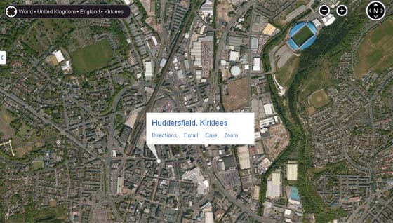
A view of Huddersfield without a cloud
A further interesting aspect of the Bing Maps update must be the bathymetric imagery. The variations in the ocean floor are shown by varying the depth of colour of the sea. “The combination of the ocean mask and bathymetric imagery provides a more meaningful view of the world oceans,” according to Microsoft.